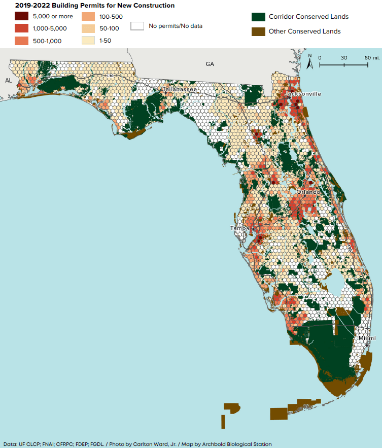
Planning future landscape
Identifying sites with urgent development threat from statewide planning data.
In an innovative partnership between Archbold conservation scientists and staff of the Central Florida Regional Planning Council, municipal planning data were collated from over 80% of municipal and county governments around the state to identify where in the Florida Wildlife Corridor is likely to be developed in the near future, without conservation. The data are publicly available, shared with conservation partners to prioritize action, and in research use to validate forecasts of future development.
Project Details
More about this project
Data and Analysis Types
Current and future zoning, parcel sizes, utilities easements GIS data. Georeferenced building permits.
Primary Location(s)
Florida, statewide
Years Active
2022–2023
Featured Publication
FLWC Statewide Study - Planning and Development Summary
Collaborators
Funders